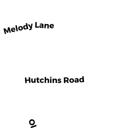
18 HUTCHINS TR
Owner Information
BARRETT RONALD P
18 HUTCHINS TR
NEWBURY, MA 01951


Property Details
18 HUTCHINS TR is classified as a Multiple Houses on one parcel (Cape).
The primary structure on this property was built in 1930. There are 3,046ft2 of built area within this property. There is 3,046ft2 of residential/living space within this property. This property is listed as having 4 rooms. There are 2 units within this property.
18 HUTCHINS TR is valued at $746,100. The land is valued at $352,300 and the structures are valued at $388,000. There is an additional valuation of $5,800 on this property.
18 HUTCHINS TR was last sold on Tuesday, May 15, 1979 for $24,000.
Assessment data from fiscal year 2022.
Flood Data
This property is partially within the AE Zone (within floodplain). Approximately 0.21 acres (84.74%) of the property is within this zone.
The base flood elevation for this flood zone is 13 feet.
This information is sourced from the FEMA National Flood Hazard Layer. See our full disclamer.
Broadband Internet Providers
| Provider | Type | Bandwidth (mbps) | |
|---|---|---|---|
| Viasat Inc | Satellite | 100 | 3 |
| Comcast | Cable | 1000 | 35 |
| GCI Communication Corp. | Satellite | 0 | 0 |
| HughesNet | Satellite | 25 | 3 |
| VSAT Systems, LLC. | Satellite | 2 | 1 |
| Verizon New England Inc. | DSL | 7 | 0 |
Broadband service provider data from December 2020.